

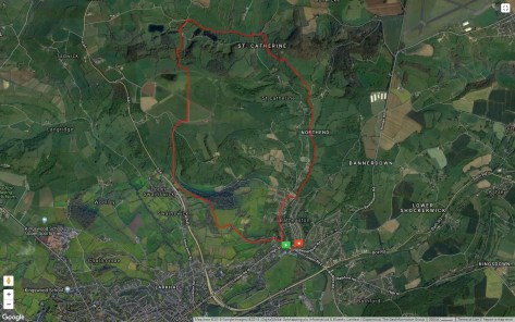
Distance: 7.5 miles
Start & finish point: ST 779 674
Difficulty: Moderate. A couple of hills (obviously). The climb to Charmy Down – the highest point on the route – is quite steep, the climb to Solsbury Hill from the north-west less so.
We pulled up in the free car park by the River Avon opposite two pubs; The White Lion and The George and Dragon – the latter has an Indian restaurant – and between the two pubs sits The Fat Friar, a chippy. One could spend a very satisfying day right there. And there’s a post office should you feel the need to write home about your experience. But our minds were on higher things. Literally.
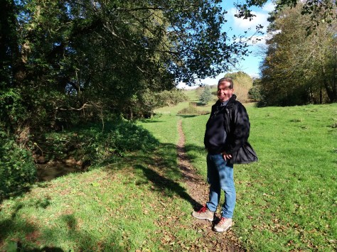
Just up the hill we turned right and joined the “Limestone Link”, a long-distance footpath between the Cotswolds and the Mendips. This took us through a residential area, across the brook at Northend and then into the fields alongside St. Catherine’s Brook, continuing north as far as Oakford Farm where the path bears north-west.
We entered a field of cattle. All were lying down, indicating rain, apart from one maverick who was wandering around eating grass. She clearly hadn’t seen the weather forecast. There were a number of cows, but also one massive bull sitting in the middle of his harem. He regarded us with insouciance and allowed us to cross his field.
In the next field we rounded a corner and surprised three deer that jumped up and ran away from us. The first two leapt the fence without a problem but the third – which looked more juvenile – tried desperately to get through the wire fence which had gaps only big enough for its head. We stood back and stood still hoping it might calm down but it continued to panic, charging the fence until finally it jumped up and over. Meanwhile we realised that we were a bit off course and needed to be further west and nearer the river. I felt guilty that our error had caused the deer alarm and possible injury. So we climbed over a gate (it was tied shut) and struggled through a barbed wire fence and brambles, me snagging myself on both (poetic justice?) and made our way downhill to re-join the Limestone Link opposite St. Catherine’s Court.
St. Catherine’s Court is a spectacular mansion on the west side of the valley. Originally a priory grange in the 16th century for the monks of Bath Abbey, it was owned for a while in the mid-eighties by the actress Jane Seymour. She got into a bit of local trouble when she let it out as a party venue – the neighbours complained about the noise. They must have been some great parties; the neighbours are miles away. There is also a recording studio, used amongst others by Radiohead to record their album “OK Computer”. They claimed the house was haunted because they “heard noises”. Um… it’s a recording studio… it’s normal for there to be noises.
No sooner had we made it back to the path than a young man with long flowing blond hair and an impressive full ginger beard came running past us. Not only was he bounding along like a gazelle but he had more than enough breath left to be able to greet us with a cheery “Good morning!”. I feel very old. Blond athlete took the high road while we continued closer to the brook, following an avenue of trees until the path veered right and eventually met a road near Ayford Farm. We took a left onto the road and then a right into the fields just before a bridge over the brook. Here we met a family with an energetic puppy. The puppy was determined to run back and forth in the road despite the woman’s exhortations. I wonder which obedience school he had failed to graduate from.
The path was now heading west to the point where it met another road at St.Catherine’s House. We turned south to the T-junction, then left and right up the hill and back into fields.
For your information – if you are trusting enough to use this as a guide to the walk – as you climb the hill you are presented with three options; a path to the left that takes you into the woods down a steep incline and too far east. A path to the right that takes you into narrow woods and will eventually get you to the right place if you can be bothered to climb a fence. Take the middle route – a permissive pathway through a gate that leads up to the former Charmy Down Airfield and the highest point on this route.
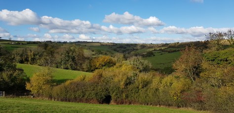
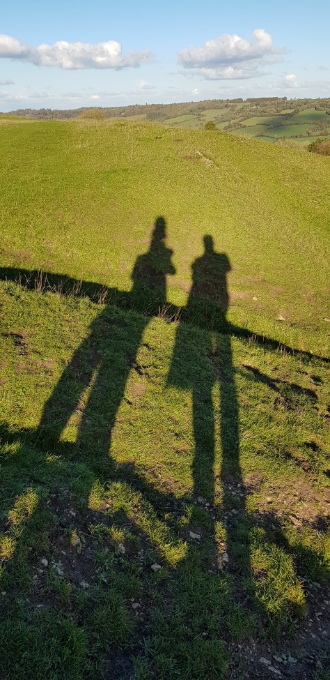
Whenever you are walking up a hill it is worth remembering to turn around and admire the view. Here you can enjoy the best of the rolling green English countryside.
Reaching the plateau of Charmy Down at first it doesn’t look welcoming, being surrounded as it is by an electric fence. But then a sign instructs you to use an insulated handle to un-hook and then re-hook the fence and enjoy your walk due south along one of the old runways. So we did. Thinking back now it occurs to me that we only crossed the electric fence once. So clearly it doesn’t actually surround the airfield.
RAF Charmy Down was only operational for a few years during WWII but some of the buildings, pillboxes and aircraft enclosures remain. Although the airfield is now covered in grass, as you walk along the runway there is still some evidence of the old tarmac and as you can see above it is very obvious on satellite imagery. Much of the perimeter road remains and as we met it at the end of the runway we turned right on to it and then left at a barn.
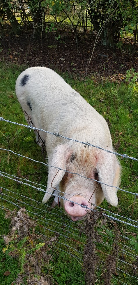
As we walked down the lane into the valley the flat top of Solsbury Hill came into view. I could see some people up there going back and forth, but Russ thought there was a tree wandering around on the top. I think he was becoming delirious. We turned left off the road and onto a footpath where we passed a group of elderly people with a small dog coming the other way. The all looked remarkably fresh so I figured the going couldn’t be that tough. We also met a friendly pig. Her mighty jaws were crunching away at something delicious she had found under a tree. She was a Gloucestershire Old Spot, and hopefully still is. I said hello and she grunted and looked back at me with intelligent eyes.
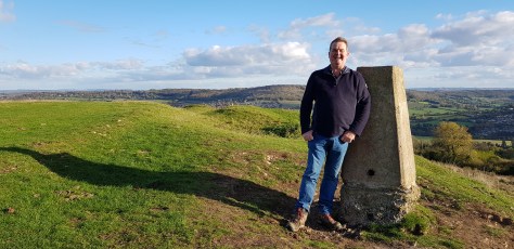
The approach to Solsbury Hill from the north-west is quite short and gentle so we soon made it to the top where we were passed by a couple running. People round here are athletic. Or maybe they were doing their own version of rock’n’roll walks and enacting Kate Bush’s “Running Up That Hill”. We continued to the trig point and took photos of each other before carrying on to the top of Solsbury Lane. The Kate Bush couple passed us again and a a few other family groups made their way up onto the hill as we were descending.
The National Trust sign at the edge of the plateau reads:- “Little Solsbury Hill. The National Trust owns only the flat top of this hill which was a walled village of the early Iron Age, occupied from about 500 B.C. to 100 B.C. At first the area near the edge of the hill top was cleared to a rock base on which substantial timber framed and wattle huts were built. A 20′ wide rampart was then made, faced inside and outside with well built dry stone walls and infilled with loose stones. The outer face was at least 12′ high. After a period of occupation some of the huts were burnt down and the rampart was overthrown. The site was abandoned and never occupied again.”
Solsbury Lane led us all the way back into Batheaston and the car park by the Avon. Again we resisted the temptations of the White Lion, The George and The Fat Friar… We got back in the car and headed for the M4.
After planning and executing this route in the context of “Rock’n’Roll Walks”, it became apparent that not everyone is familiar with Peter Gabriel’s early solo work. Whether you are or not, take a look at this and see masterful musicians at work:-
https://www.youtube.com/watch?v=WeYqJxlSv-Y
Gabriel wrote the song about a spiritual experience atop Little Solsbury Hill in Somerset, after his departure from the prog-rock band Genesis, of which he had been the lead singer since its inception. Gabriel himself said of the song’s meaning, “It’s about being prepared to lose what you have for what you might get … It’s about letting go.”

I’m in awe of your get up and go!! And just a little ashamed of my own 30 minute dog walks… Wonderful to see the views of the English countryside too. Keep it up!!
Caroline 🙂
LikeLike